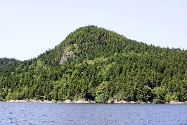
The mostbeautiful spot on our river....
Minister’s Face Preserve consists of approximately 147 hectares (364 acres) of land on Long Island. The island is located in Kennebecasis Bay, Kings County, approximately 12 kilometres north of Saint John, NB. The cliff formation rises 200 feet from the river on the northeast side of the island. The land features several kilometres of the popular sandy Rayworth Beach on the southern end of the island.
History
Long Island was inhabited from 1785 until the 1960s. Signs of previous human occupation are visible throughout the uplands, in the form of crumbling stone building foundations, cleared fields, rock piles and an abandoned road that runs the entire length of the island.
Because of its prominence as a landform and the known presence of rare species, the Nature Trust entered into talks with the landowner in 1999 about the possible sale of the land to the Trust. It was officially purchased and became protected in 2001. In July 2005, 4 hectares (10 acres) of land were purchased on Minister’s Face. In September 2005, 45 hectares (110 acres) were acquired, two-thirds of which was purchased while the remaining third was generously donated to the Nature Trust as an ecological gift.
Ecology
The cliffs of Minister’s Face have high ecological significance and have been recognized as an Environmentally Significant Area due to the presence of habitat for rare arctic flora, as well as providing a spectacular view from the eastern banks of the Kennebecasis. The vertical rock cliffs have been host to significant botanical findings from as early as 1866.
The majority of the preserve is covered by young mixed coniferous/deciduous forest of fir and birch, with a rich understory of ferns; mature cedar stands dominate portions of drier slopes. The rugged rocky exposures in the area of Minister’s Face are among the only areas that were not harvested on the island. In small sheltered forest outcrops and open rock faces along the shoreline, rare plant species have been able to persist. The unique composition of the cobbles and boulders of Precambrian marble present on most of the island provides an excellent substrate for these significant plants. Rare arctic disjunct flora such as livelong saxifrage (Saxifragapaniculata) and alpine woodsia (Woodsiaalpina) are known only in a few other locations in the province. Rare species such as smooth draba, livelong saxifrage and others have been known here since the late 1800′s, however the discovery of the extremely rare (S1) wall-rue fern (Aspleniumrutia-muraria) during a botanical inventory on the island was especially significant, as it had not been previously found anywhere in New Brunswick.
The land also serves as an impressive lookout, as well as a nesting site, for a pair of Peregrine falcons. |


